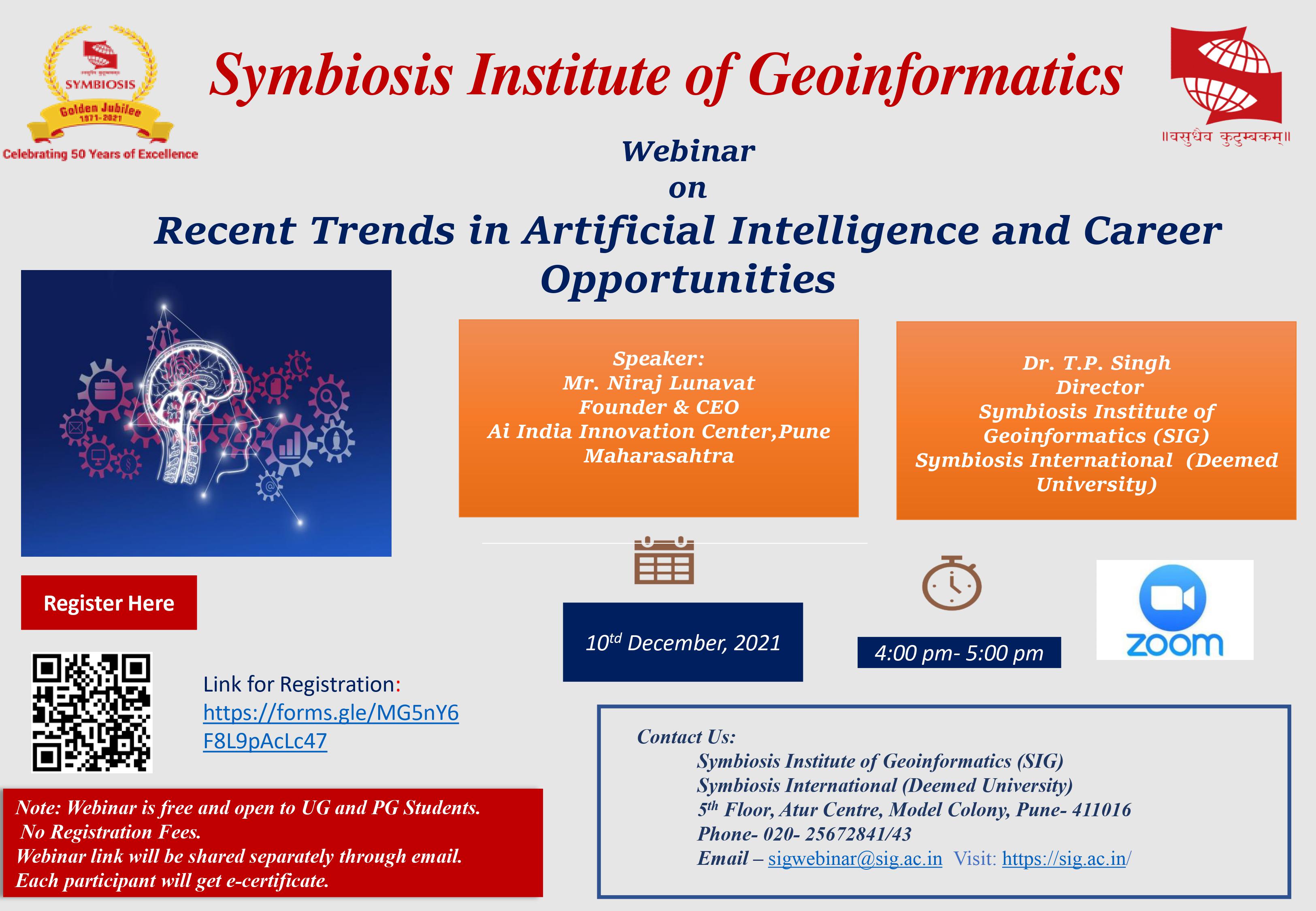
Webinar on Recent Trends in Artificial Intelligence and Career Opportunities

M.Sc.(Geoinformatics) offered by Symbiosis Institute of Geoinformatics (SIG) comprises of 80 credits, spread across 4 semesters. Comprising of two projects, the degree is conferred under the Symbiosis International University.
M.Sc.(Geoinformatics) offered by Symbiosis Institute of Geoinformatics (SIG) comprises 80 credits, spread across 4 semesters. Comprising two projects as expected from a good masters in geoinformatics in India, the degree is conferred under the Symbiosis International University.
Earth and atmospheric science relies on spatial data acquired from satellite,aerial images or other means, which are analyzed by the expert using Geospatial technology. The field of Geoinformatics consists of Remote Sensing, Geographic Information System (GIS), Global Navigation Satellite System (GNSS) with Information Technology among many other aspects. Many fields benefit from geoinformatics, including urban planning and land use management, navigation systems, public health, environmental modeling and analysis, military, transport network planning and management, agriculture, meteorology and climate change, oceanography and atmosphere modeling, business location planning, architecture and archaeological reconstruction, telecommunications, criminology and crime simulation, Business management, aviation and maritime transport.
Geoinformatics and by extension MSc geoinformatics colleges in India have become very important for decision-makers. Many national and international agencies are using spatial data for managing their day to day activities.
Geoinformatics is a specialized field necessitating expert knowledge. SIG has emerged as one of the leading MSc geoinformatics colleges in India with their commitment, quality of education and legacy as a Symbiosis institute.
Students from Engineering, Science, geography, geology, agriculture, environment, forestry engineering, IT or computer science fields can opt for a masters in geoinformatics in India from SIG.
Details of M.Sc. Geoinformatics course curriculum are given below
Generic Core Courses
Generic Core Courses
Generic Elective Courses Group
Generic Elective Courses Group
Industry Project
The geoinformatics field is in its nascent stage and expanding at a rapid pace as more and more industries are employing spatial data to manage their activities. The dream of the digital India , Smart cities can not be completed without the use of Geoinformatics technology. Almost no developmental project is complete without geospatial information and it will soon become imperative. The only limit is the acute shortage of skilled professionals. Therefore, there is tremendous scope with accelerated growth and development prospects. The pervasive use in diverse disciplines ensures a wide variety of employment opportunities. The Government of India is taking numerous initiatives under Department of Space, Department of Science & Technology (Natural Resources Data Management System - NRDMS) and others. Government/has also established National Centre of Geoinformatics to serve central & state govt dept across the country . Likewise many others initiatives are in process."
The industry is rapidly adopting these technologies for efficient delivery of products or processes. Companies such as Reliance Industries, Reliance Jio, Lavasa Corp, L&T, Suzlon are using geospatial technology for infrastructure project management. Many IT companies are handling overseas projects based on Geospatial technologies, these include, Infosys, TCS, HCL,Acenture,Tech Mahindra,Google, iGate etc. In addition to these industry giants several midsize companies such as ESRI Inc., Intergraph, Nokia,Tom Tom,Webonise Lab operates on specialized geospatial products. Many companies are in Insurance sector like WILLIS RE,SWISS RE are using Geospatial technology in big way. These companies offer variety of opportunities as GIS analyst, GIS managers, Business development executives, GIS software developers etc.
In Govt Sector Central and State government departments are using geoinformatics application. Central government agencies are under the Department of Space - National Remote Sensing Centre (NRSC Hyderabad), North East Space Application Centre, (NESAC Shillong), Regional Remote Sensing Centres (RRSC Kharagpur, Dehradun, Jodhpur, Nagpur and Bangalore), Indian Space Research Organisation, (ISRO Bangalore), Advanced Data Processing Research Institute (ADRIN Hyderabad) and Space Application Centre (SAC Ahmedabad), Defense Research and Development organization (DRDO), Department of Science and technology, Ministry of Environment , Ministry of Agriculture forest and Climate Change, Ministery of Earth Science,Geological Survey of India, Indian Agriculture Research Institute (IARI) and Indian Council of Agriculture Research (ICAR) Apart of these many public sector unit have Geospatial Departments
Duration: The M.Sc. Geoinformatics program is a 2 year full time course.
|
Programme Name: M.Sc(Geoinformatics) |
|
|
PO1 : |
To create professionals in the field of Geospatial Technology |
|
PO2 : |
To develop the skills required to cater to the needs of global Geoinformatics industry |
|
PO3 : |
To develop Hand on Learning experience for spatial data handling |
|
PO4 : |
To provide industry exposure to understand application technology |
